

Stage 02 From Glacier to Wine North Route Guttenberghaus - Stoderzinken
Tour description
The tour
Map, elevation profile & further information
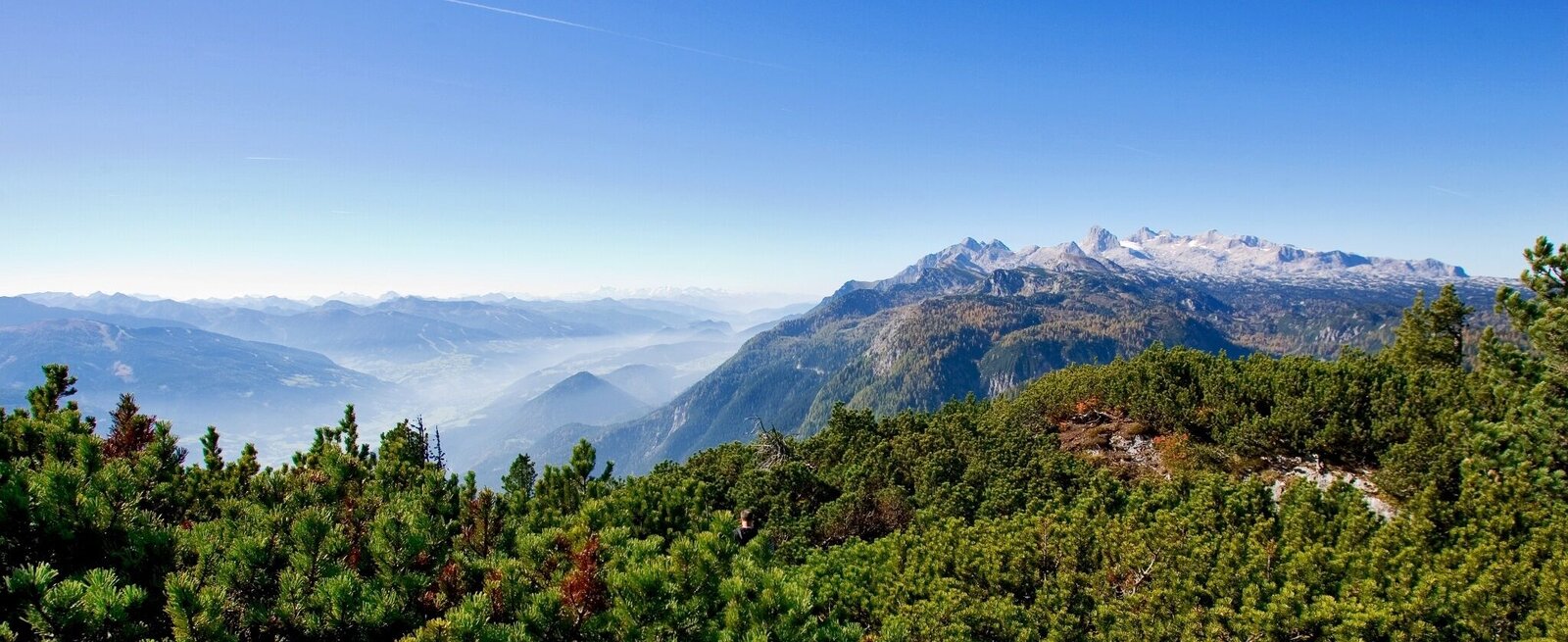
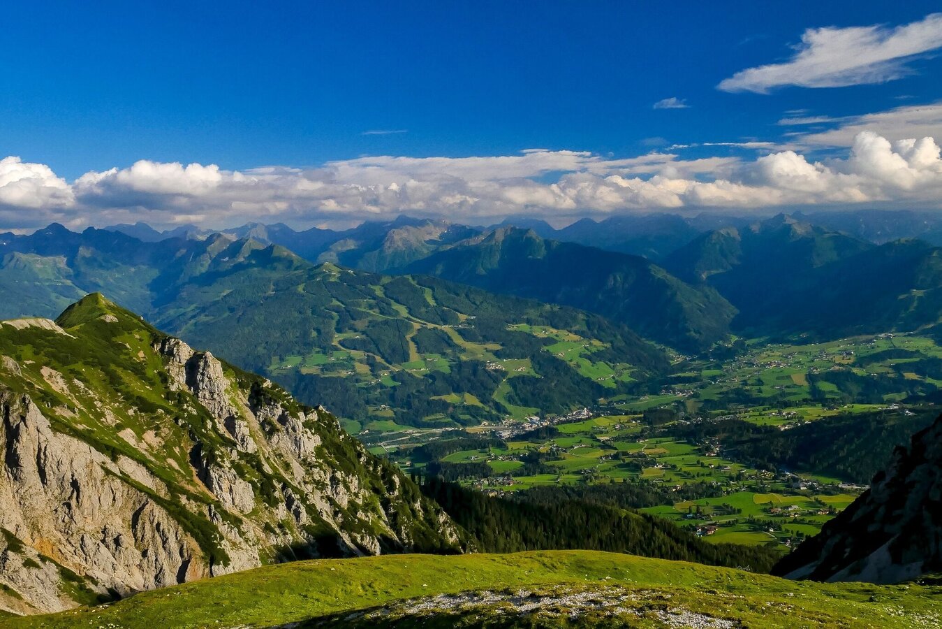
At first, you will follow the path back to the Feistererscharte, a central crossing point above the Guttenberghaus. Follow path no 618 past the northern side of the Sinabell leading through impressive, barren scenery. This seemingly endless stretch of grey rocks is only contrasted by the green of the natural pits and mountain pines. To the east, the Stoderzinken and Grimming summits cover the horizon; on the north side, you can see the endless mountain range of the Totes Gebirge (Dead Mountains).
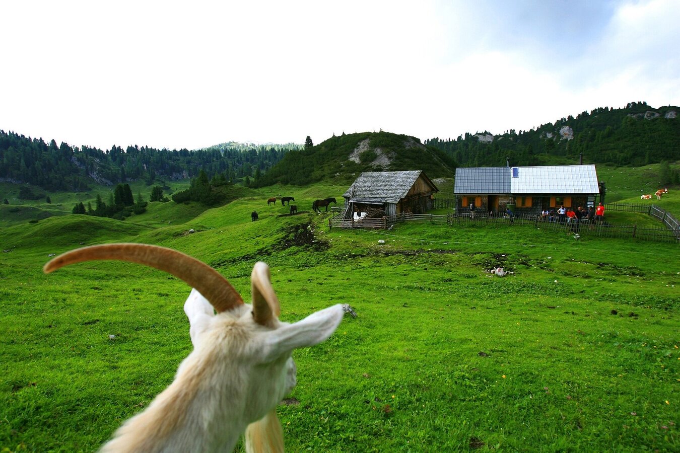
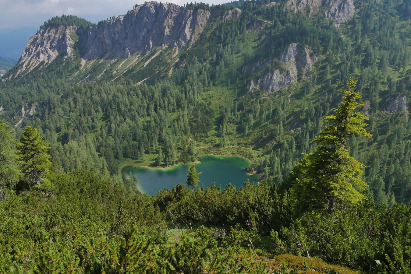
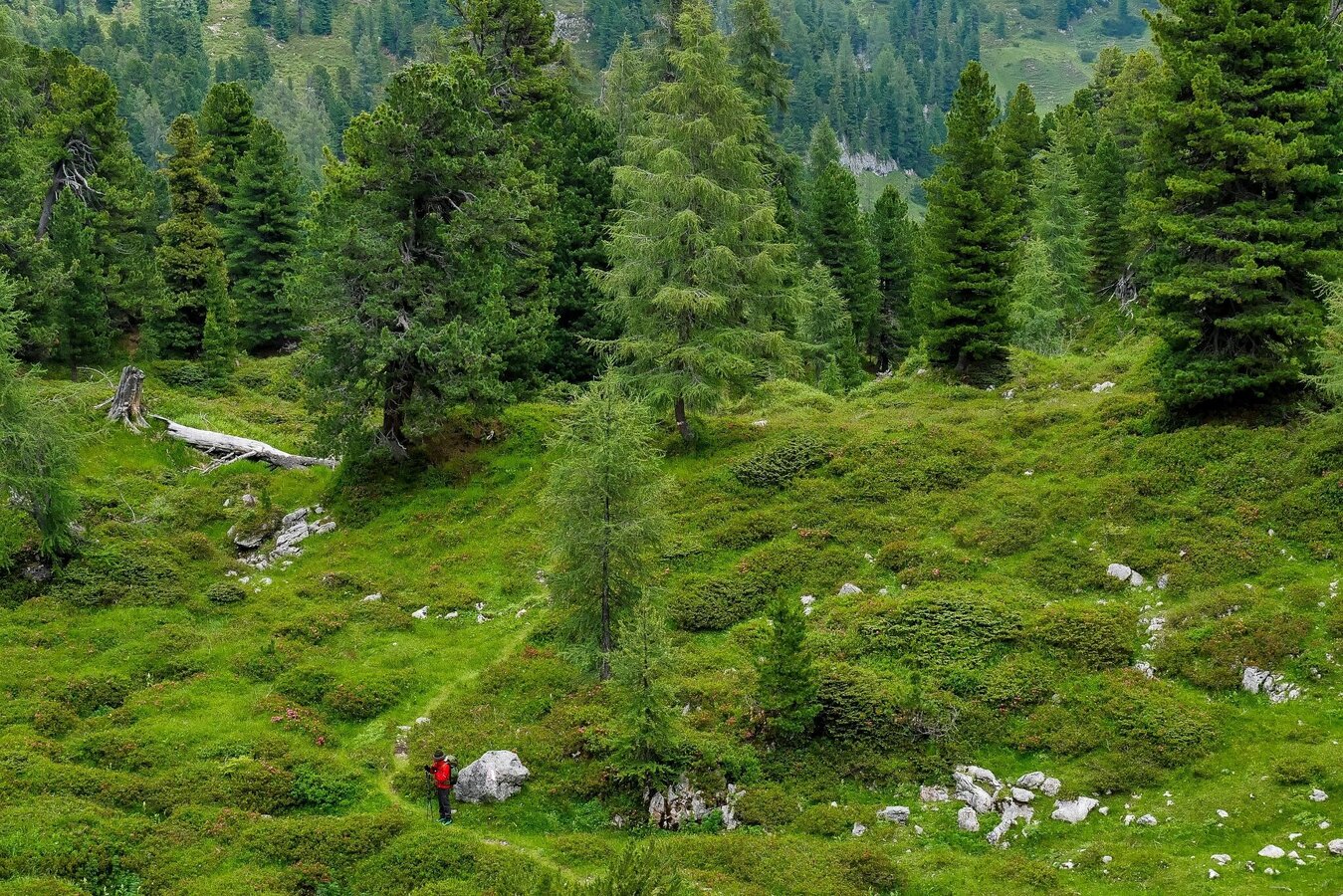
After about an hour's walk, the sight of the Höllgrabensee lake deep below provides a welcome change in this otherwise rather barren rocky landscape. In early July, the basin surrounding the lake is covered in alpine roses. The rest of the route to the Grafenbergalm is characterized by a charming landscape with rocky outcrops, mountain pines, flower meadows, gorges and small rock walls. Once you reach the Grafenbergalm, it immediately becomes clear why this place is so special. The alpine basin with its green meadows, the beautifully situated Grafenbergsee lake and groups of stone pines offers a setting that is second to none.
From the Grafenbergalm onwards, you will experience a change of scenery: forests with beautiful views onto the surrounding mountain ranges and kettles covered in a diversity of flowers. The path will constantly change direction, times following around a rock wall, then back through the woods. The path offers a varied experience until the end - just like the landscape of Styria.
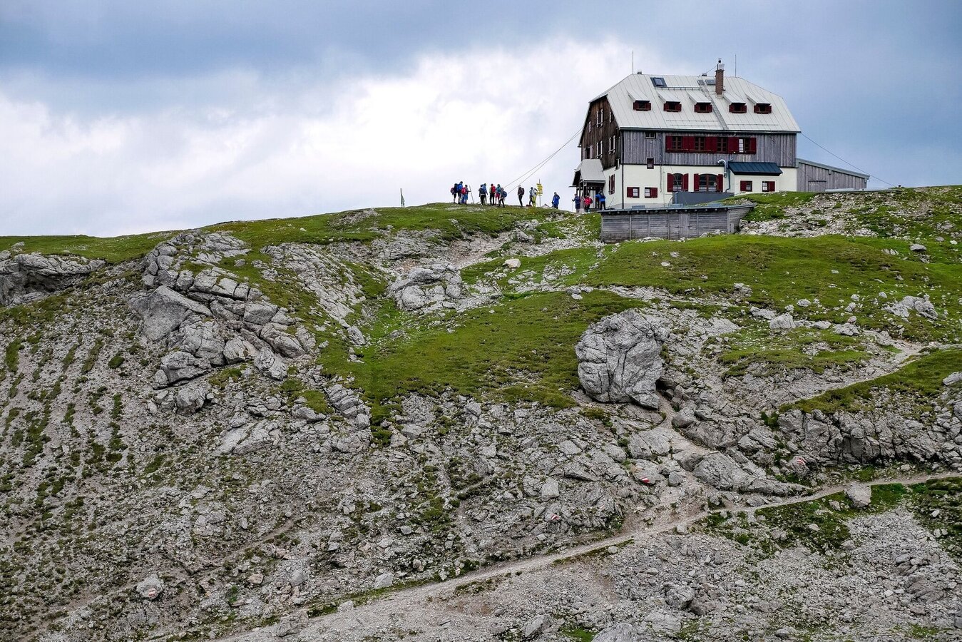
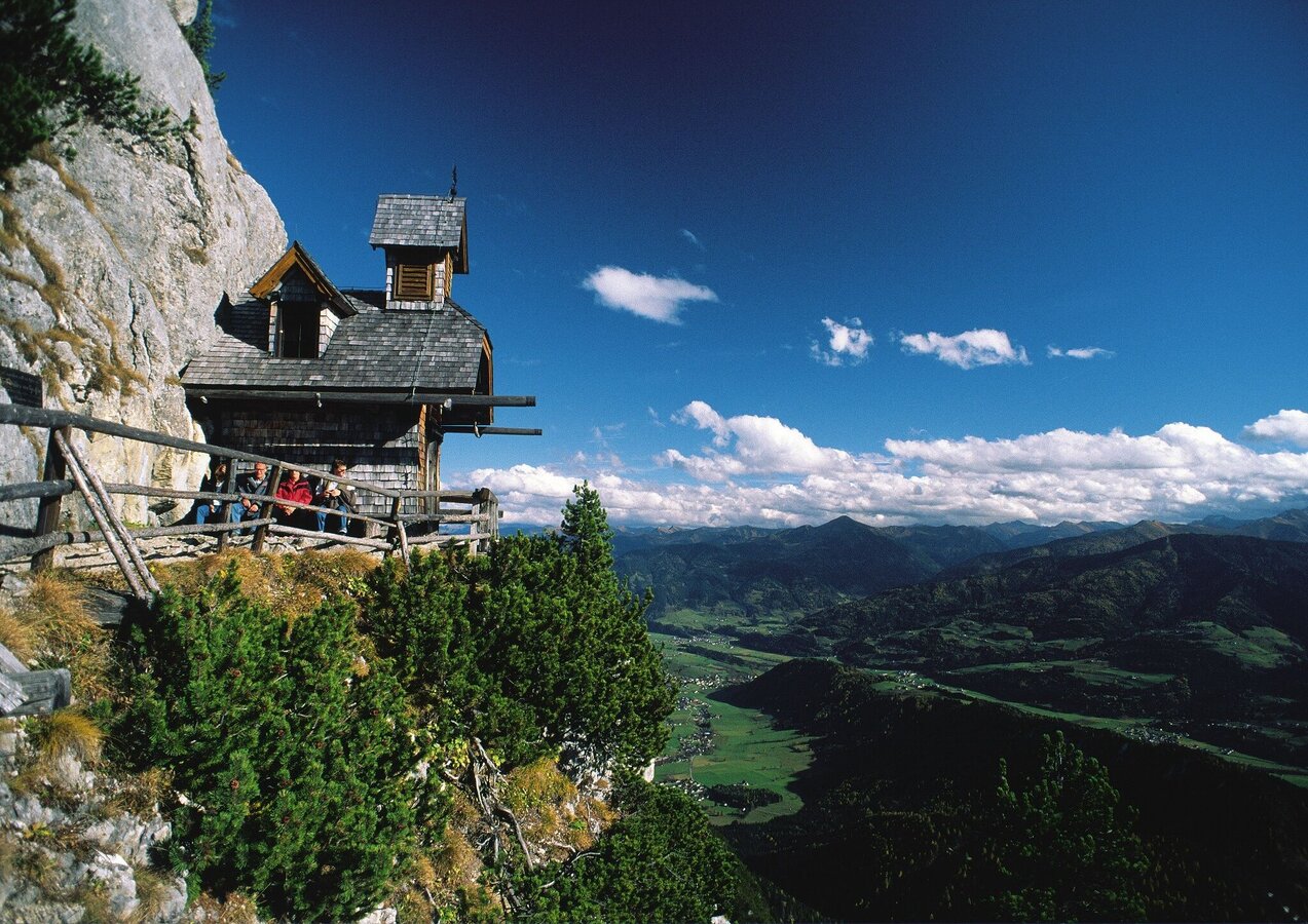
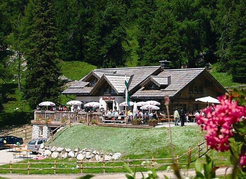
Through a clear larch forest, the path gently winds up the Brandner Urwald (virgin forest) to the Brunnerhütte (no refreshments offered here). From there, you will walk another 20 min to the Steinerhaus (Tel. +43 3686 30960), a guesthouse with all the comfort and advantages, close to Stodezinken’s summit. The summit will offer beautiful views to the eastern Alps (Tourist Info Centre Tel. +43 3685 2213122). For a culinary delight, stop by the Rosemi Alm (Tel. +43 3686 30960) or the Stoderhütte (Tel. +43 3686 2646 – owned by the Steinerhaus), both close to one another.
Alternatively, you can spend the night on the idyllic Viehbergalm in the Rizingerhütte (Tel. +43 3685 22474 or +43 67 9459817), an intermediate stopover of Stage 3. The Rizingerhütte offers a fantastic location with culinary treats and, a beautiful dorm with 8 beds. This variant of stage 2 adds 17 km in length as we take a left from the Brünnerhütte to the Notgasse and the Viehbergalm. As a result, Stage 3 to Bad Mitterndorf will be shorter by 13 km.
Accessible by train and bus.
Detailed information about arriving by ÖBB (Austrian Federal Railways) can be found at www.oebb.at or on the Verbundlinie Steiermark website www.busbahnbim.at
With Verbundlinie’s BusBahnBim route planner app, planning your journey has never been easier: simply enter towns and/or addresses, stop names or points of interest to check all bus, train and tram connections in Austria. The app is available free of charge for smartphones – on Google Play and in the App Store
Emergency call mountain rescue: 140
Tips when reporting an emergency – Answer these six WH questions: What happened? How many people are injured? Where did the accident happen (are there GPS coordinates)? Who is reporting the incident (callback number)? When did the accident happen? What is the weather like at the site of the incident?
Proper backpack packing makes many things easier: Pack heavy things first. The water bottle should always be within reach in a side pocket. All the things that are often needed, such as sunglasses, camera or hiking map, belong on top. An emergency kit, including blister plasters, belongs in every rucksack and it is always advisable to dress in layers.Steiermark Tourismus
Tel. +43 316 4003
If you would like to hire a tour operator, simply book with Steiermark Touristik, the official travel agency of Steiermark Tourismus:
Tel. +43 316 4003 450,
The Steiermark Touren app, available free of charge on Google Play and the App Store (Android, iOS), offers detailed first-hand information: brief facts (length, duration, difficulty, ascent and descent/elevation gain, ratings), map, route descriptions, altimeter, compass, peak finder, navigation along the tour. You can also create your own personal lists of favourite tours and sites, store tours and destinations offline, use social media channels, and much more.
Pocket Card Wanderroute "Vom Gletscher zum Wein" (in German) www.steiermark.com
Wanderkarte Schladming-Dachstein, 1:50.000 www.schladming-dachstein.at
Kompass WK293 Dachsteingruppe, Schladminger Tauern www.kompass.at
Freytag & Berndt WK281 Dachstein · Ausseer Land · Filzmoos · Ramsau www.freytagberndt.at
Rother Wanderführer "Vom Gletscher zum Wein" (in German): www.rother.de


