right in the middle of
logo-schladming-dachstein-box-hellgruen-einzeilig-png | © Schladming-Dachstein
contact
9 / 84 lifts
Webcams
5 °C
back
Schladming

From Tetter Inn to Krahbergzinken summit

Tour description

Quite a challenging tour to one of Schladming's "Hausberg" mountains - the Krahbergzinken. This tour leads over steep slopes from Untertal to Krahbergzinken summit, which is a magnificient view point and used to be a mining area. The ascent from the Tetter Inn to Krahbergsattel mountain saddle is quite steep and challenging.

The tour

closed
moderate
Starting point Gasthof Tetter Inn, Untertal
Destination Planai cable-car, mountain terminal 2nd section
Tour characteristics
Fitness (4/6)
Skills (4/6)
Information
Distance: 7.06 km
Duration: 4 h 1 min
Ascent: 1174 m
Descent: 395 m
highest point: 2134 m
Best season
Jan
Feb
Mar
Apr
May
Jun
Jul
Aug
Sep
Oct
Nov
Dec

Map, elevation profile & further information

From Gasthof Tetter Inn you follow trail n° 54 ascending quite steeply towards the mountain saddle "Krahbergsattel". Interrupted by short sections along forest roads, the trail takes you to Krahbergalm in about 2 hours. Shortly after you reach the last hairpin of the Planaistraße road and a bit further you reach the mountain saddle.

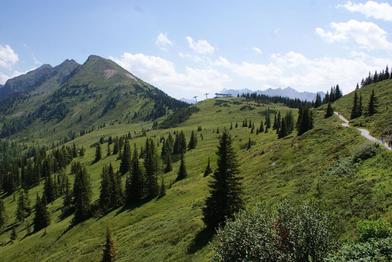
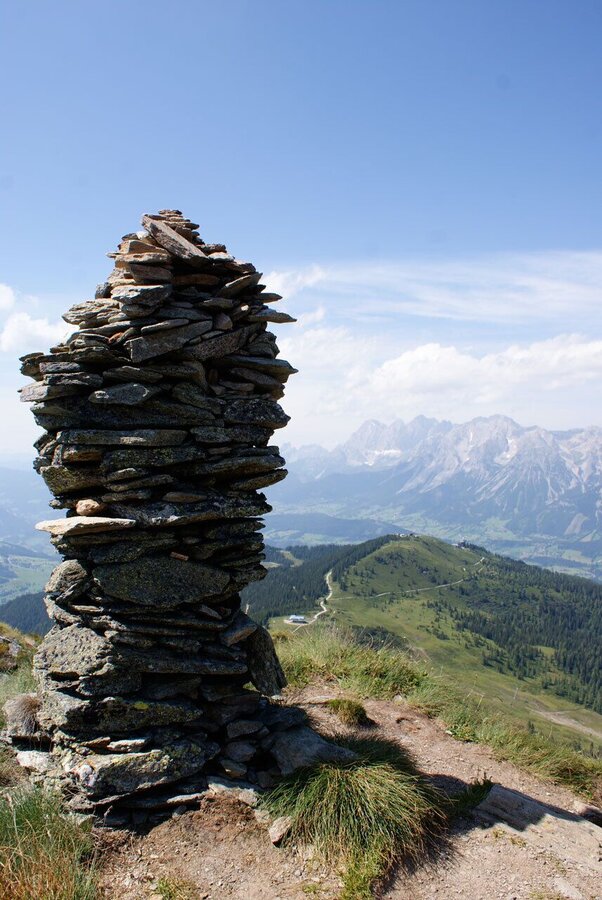
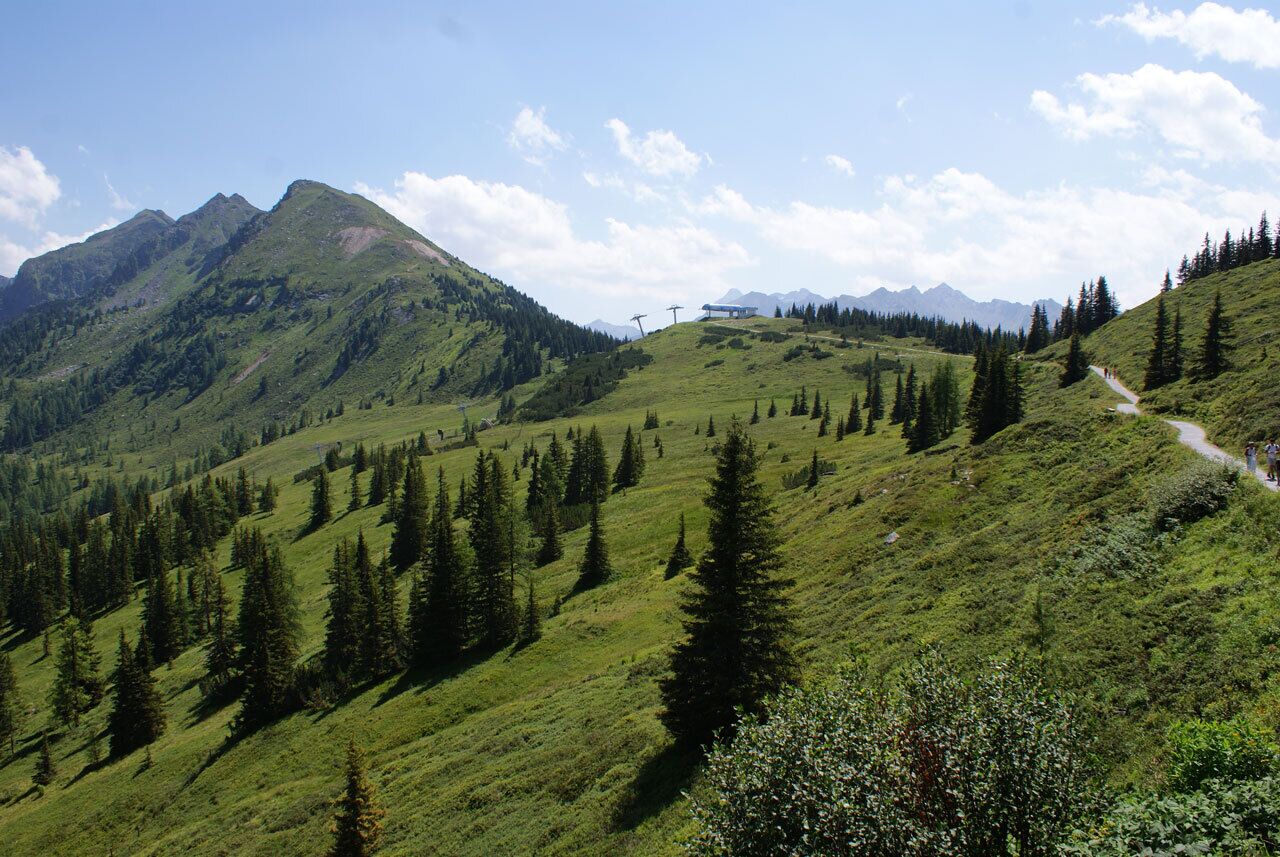
After a break you follow trail n° 779 towards Krahbergzinken. Passing by the scree left from the medieval mining activities you reach one of the best view points of the region. Until Krahbergsattel you follow the way you came and then contine on trail n° 779 to the mountain terminal of Planai cable-car. You can choose whether you take the Planai panorama trail around the summit or extend for another 15 minutes to also cover the summit of Planai itself. From the mountain terminal take the cable-car back to Schladming.

If you are willing to walk downhill for another 2 to 2.5 hours and 1,100 meters in elevation you can also descend via one of several trails (numbers 50, 53, 55, 779) to Schladming.

From Schladming take provincial highway L722 (Rohrmoosstraße road) to Rohrmoos and at the roundabout continue on provincial highway L723 (Tälerstraße road) towards Untertal. From the village of Untertal continue for another 3 kms until you reach Gasthof Tetter Inn. As the end of the tour is not at your starting point we recommend to take the bus from Planet Planai in Schladming to Gasthof Tetter in Untertal.Parking is available at the valley terminal of Planai cable-car (Planet Planai) - take the bus from here to Gasthof Tetter.
With the Planai buses from Schladming (Planet-Planai, Lendplatz) or Rohrmoos (Rohrmoos-Zentrum) to Untertal - bus stop "Gasthof Tetter".
Shortly before reaching the summit there is a short section secured with steel ropes.

Changes in weather patterns, quick falls in temperature, thunderstorms, wind, fog and snow are some of the dangers that can be encountered on a hiking tour. Hosts of alpine huts and mountain refuges have a lot of experience in the mountains and can give good advice about weather and the trails. Poor equipment, overestimation of one's own capabilities, carelessness, poor personal constitution and/or wrong judgement  can lead to critical situations. In case of thunderstorms: avoid summits, ridges and steel ropes.

GPS data and orienteering

Available GPS data - just like hiking maps - is only a guidance for orientation and can never depict a trail exactly with all its details. Especially at dangerous spots it is essential to judge on site how to proceed.

In an emergency please call:

  • 140 - for Alpine emergencies (all over Austria)
  • 112 - European GSM emergency number
A well-packed backpack is helpful and especially when touring Alpine terrain a tuque, gloves, a windproof jacket and pants are standard equipment. Good, waterproof shoes, sun glasses, sun cream and sufficient beverages are essential too. Torch light, a map of the area, knie and a small first-aid kit should also be in the backpack.
While ascending to Krahbergsattel mountain saddle you might encounter quite some wild strawberries :)Tourist information: www.schladming.com

Information about bus schedules: www.planaibus.at

Information about cable-car hours: www.planai.at
 

  • Hiking map ‘Hiking WEST’ available at the information offices in the region.
  • Schladming hiking map, 1:25,000, available at the Schladming information office.
  • Hiking map Schladming-Dachstein, 1:50,000, available at the information offices in the region.
  • Hiking guide Schladming-Dachstein by Herbert Raffalt, available at the information offices in the region.


Wheather predicition

today
05.10.2025
Mountain 1 °C
Valley 8 °C
Precipitation
Probability
85 %
Amount
14.3 l/m²
Wind speed
Nordwest
15 km / h
Sun
Sun hours
1.5 h
Sunrise
07:10 o clock
Sunset
18:36 o clock

Frequent snowfall. A slight chance of sunshine in the afternoon.

tomorrow
06.10.2025
Mountain 1 °C
Valley 9 °C
Precipitation
Probability
90 %
Amount
29.3 l/m²
Wind speed
Nordwest
20 km / h
Sun
Sun hours
0.7 h
Sunrise
07:11 o clock
Sunset
18:34 o clock

Thick clouds and widespread snowfall throughout the whole day.

day after tomorrow
07.10.2025
Mountain 4 °C
Valley 11 °C
Precipitation
Probability
85 %
Amount
13.4 l/m²
Wind speed
Nordwest
15 km / h
Sun
Sun hours
0 h
Sunrise
07:13 o clock
Sunset
18:32 o clock

Snowfall and sleet will persist into the afternoon. Afterwards dry, but hazy.

Tours nearby