

Alpine trail through "Höll" gorge
Tour description
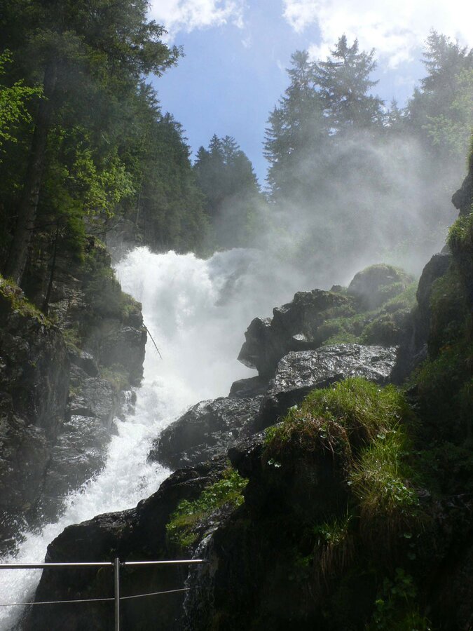
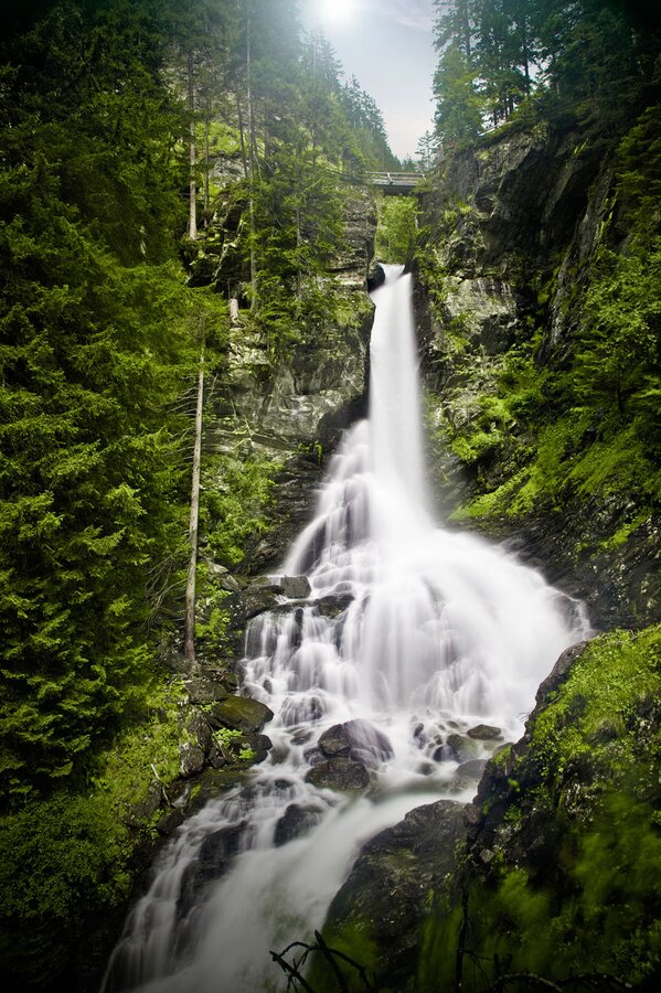
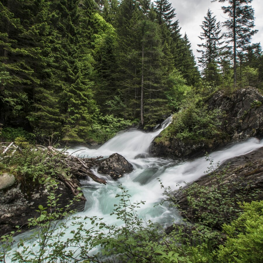
Discover the imposing Riesach Waterfall, the highest in Styria. The masses of water thunder two stages and 140 meters to the valley below. Highlight: alpine trail with steel suspension bridge.
Trail characteristics:
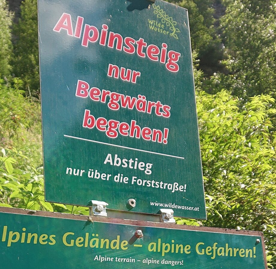
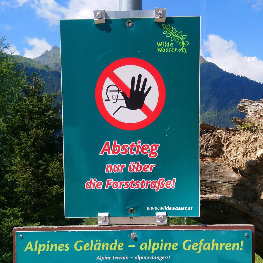
Steep forest trail alongside Riesach Waterfall, then to lake Riesachsee on an easier forest lane, or along the challenging alpine trail "durch die Höll" (through Höll), which is not suitable for children below the age of 8 years or for dogs. The alpine trail is for ascent only - no descent along the alpine trail!
Restaurants:
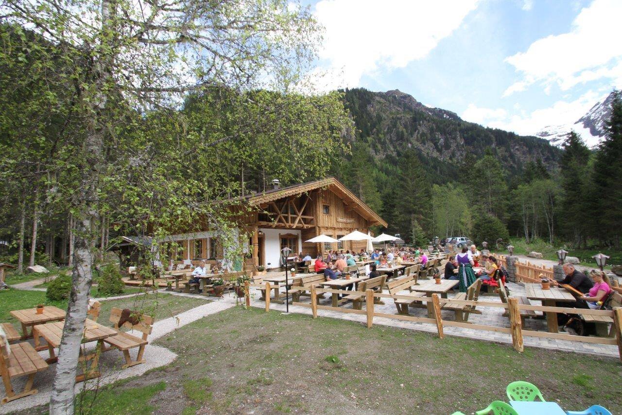
- Almgasthaus Riesachfall
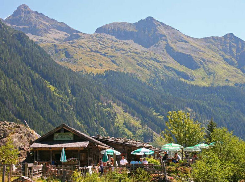
- Gfölleralm
- Kaltenbachalm
Highlights:
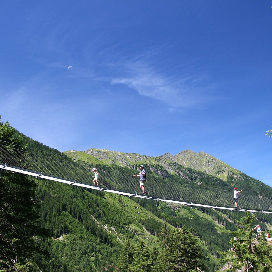
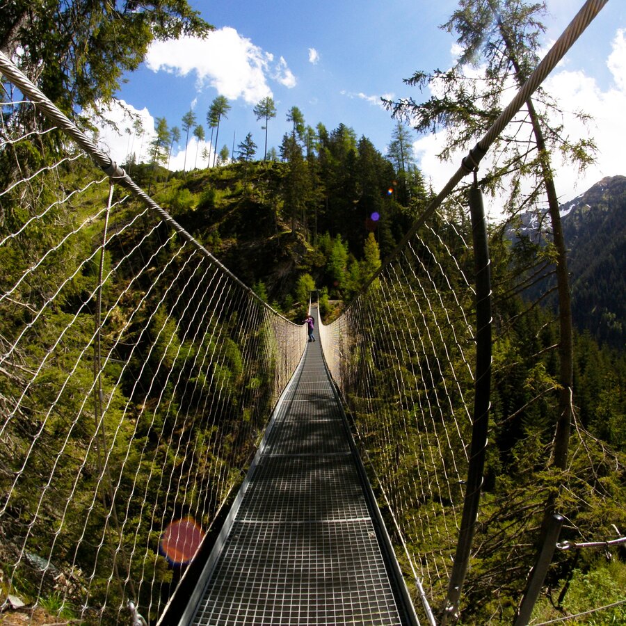
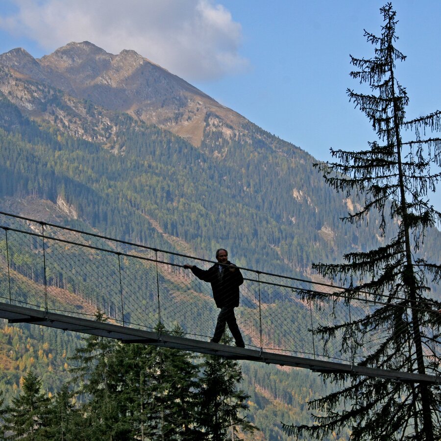
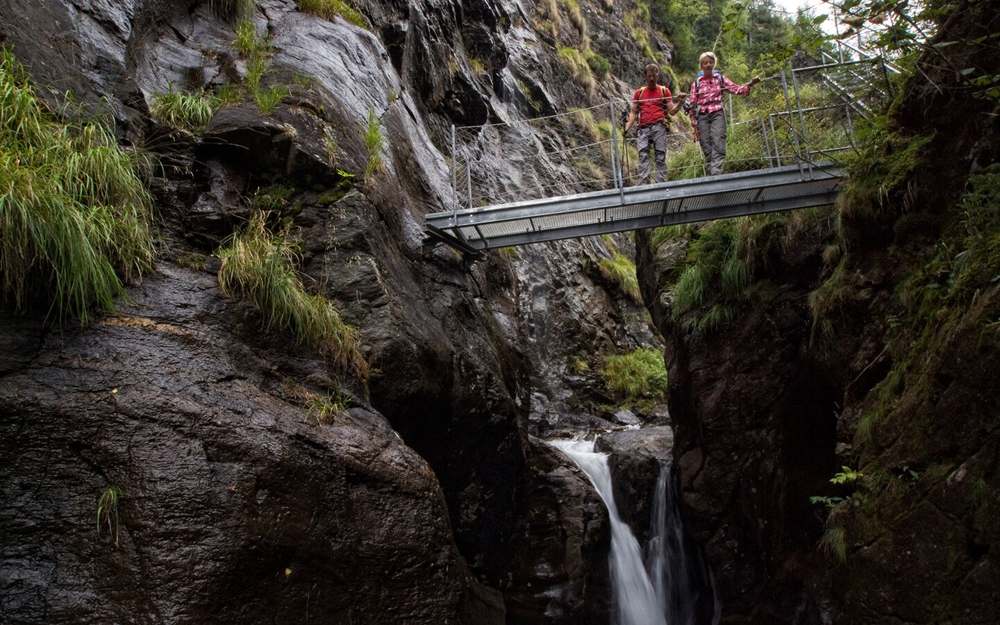
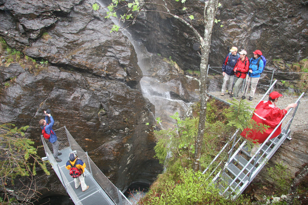
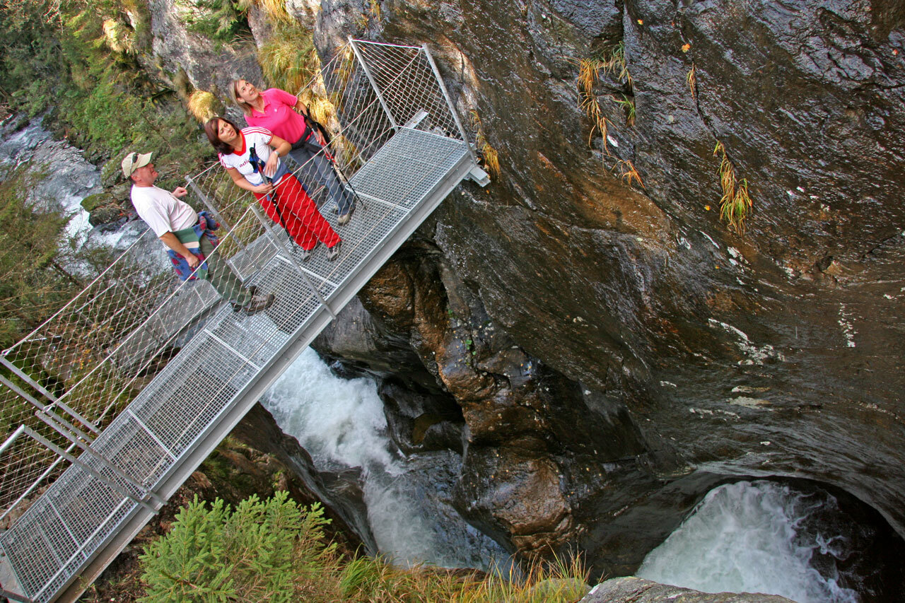
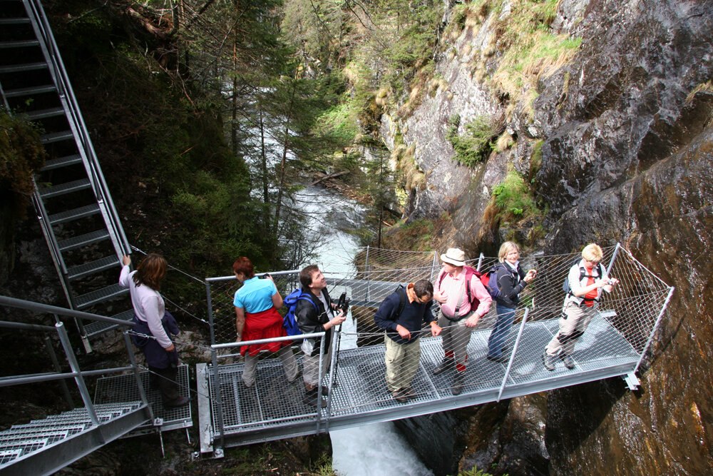
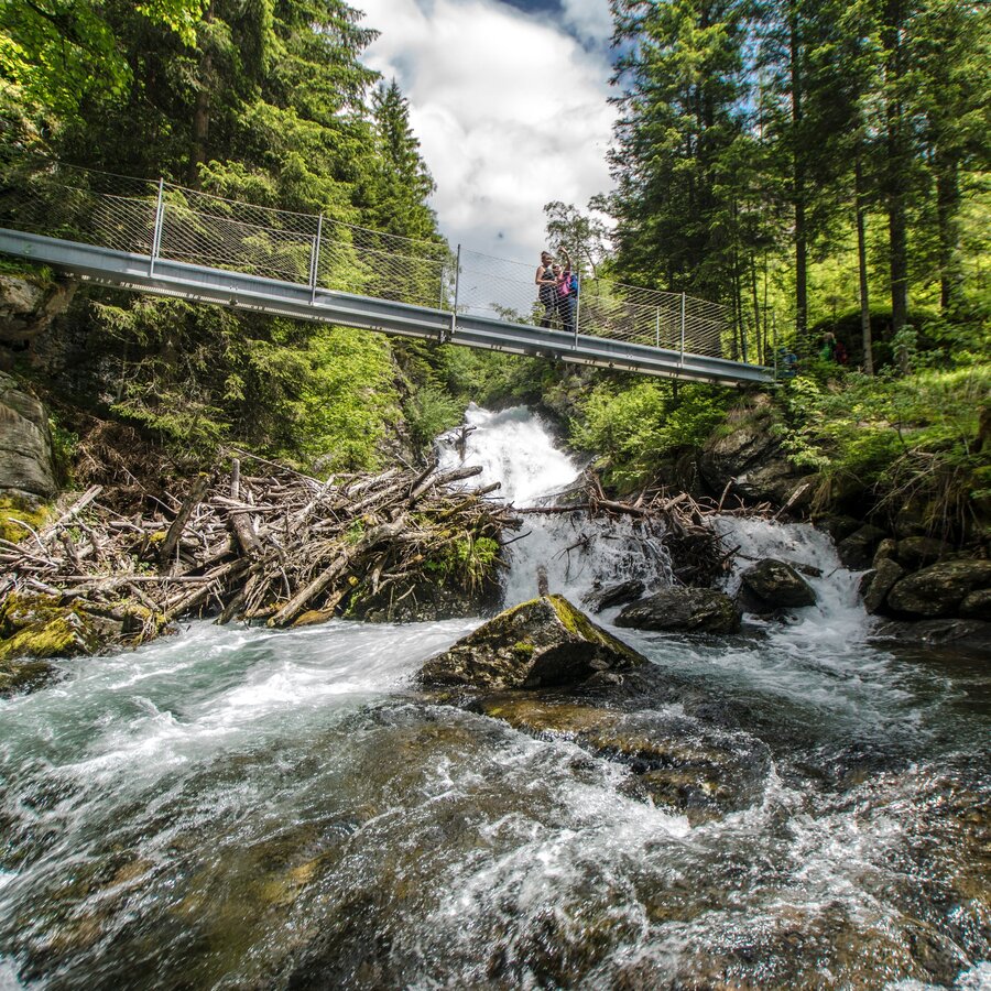
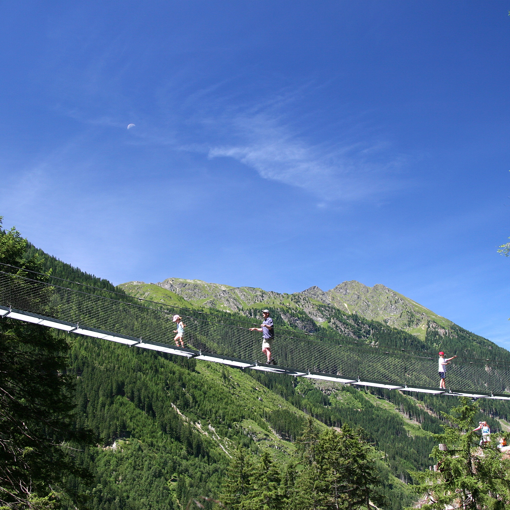
- 50 meter long steel rope suspension bridge
- Viewing platforms in the gorge
- Riesach Waterfalls
- Riesachsee Lake
The tour
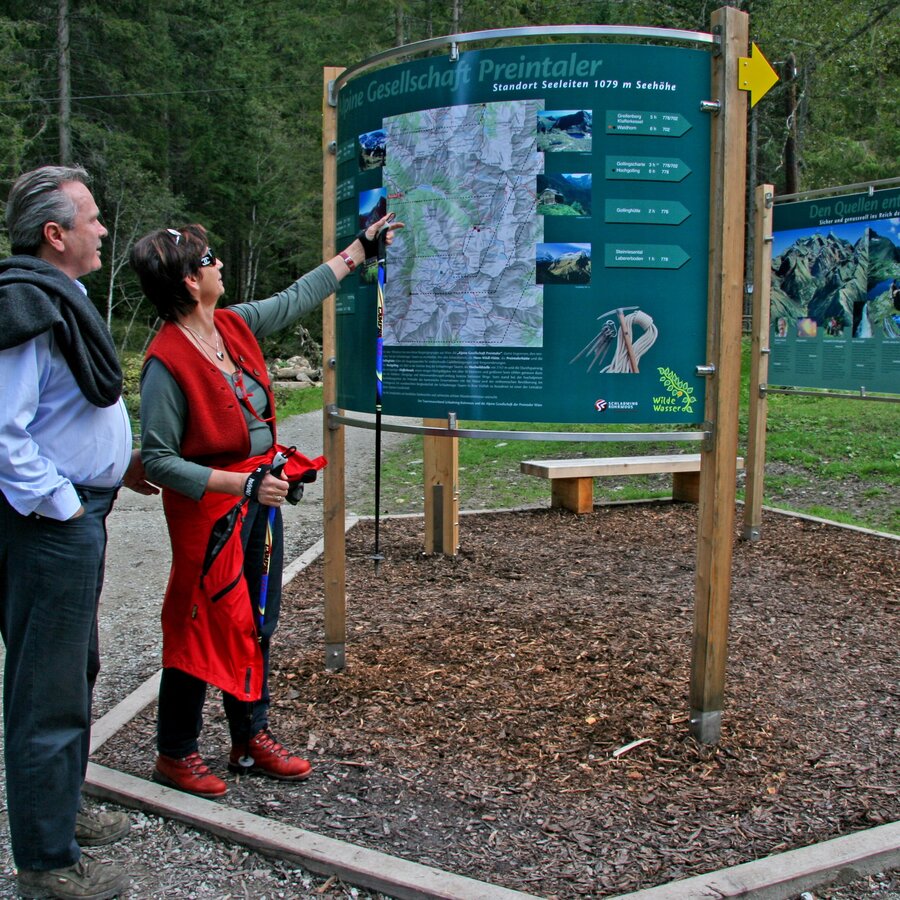
Map, elevation profile & further information
From Almgasthaus Riesachfall the ascent is along a steep hiking trail with steps, located close to the water and a truly memorable experience, with viewing platforms and a 50 m cable footbridge. If this sounds a little too adventurous for you, or if you are hiking with children under eight, you can continue your hike to Riesachsee Lake, prior to reaching the cable bridge, along a forest lane.
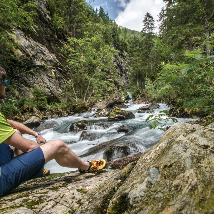
In the canyon, the hike continues along the ››durch die Höll‹‹ alpine trail. It is well secured and features countless steps and stairs. You are mostly close to the rapid, untamed waters of the stream, able to feel how pristine this natural setting truly is and discovering so much along the way. A beautiful view reveals itself upstream, as the summit of the Hochwildstelle becomes visible. Via a steep ladder you climb out of the trail right by the pleasant Gfölleralm.
Just a few steps further is the deep-green Riesachsee Lake (elev. 1,338 m), flanked by lush forests and high mountainsides, while on the left shore the Kaltenbachalm invites you to enjoy a well-earned refreshment stop.
We recommend returning along the forest lane.
ATTENTION: there is a parking fee at the public parking lots in Untertal valley.
- Buses of Planai-Hochwurzen-Bahnen: www.planaibus.at
Surefootness required, unsuitable for children below the age of 8 years and dogs.
Changes in weather patterns, quick falls in temperature, thunderstorms, wind, fog and snow are some of the dangers that can be encountered on a hiking tour. Hosts of alpine huts and mountain refuges have a lot of experience in the mountains and can give good advice about weather and the trails. Poor equipment, overestimation of one's own capabilities, carelessness, poor personal constitution and/or wrong judgement can lead to critical situations. In case of thunderstorms: avoid summits, ridges and steel ropes.
GPS data and orienteering
Available GPS data - just like hiking maps - is only a guidance for orientation and can never depict a trail exactly with all its details. Especially at dangerous spots it is essential to judge on site how to proceed.
In an emergency please call:
- 140 - for Alpine emergencies (all over Austria)
- 112 - European GSM emergency number
Tourist information: www.schladming.com
Information about bus schedules: www.planaibus.at
Website Wild Waters with 360° images: www.wildewasser.com
- Hiking map ‘Hiking WEST’ available at the information offices in the region.
- Schladming hiking map, 1:25,000, available at the Schladming information office.
- Hiking map Schladming-Dachstein, 1:50,000, available at the information offices in the region.
- Hiking guide Schladming-Dachstein by Herbert Raffalt, available at the information offices in the region.


