

Keinprechthütte - Gollinghütte | Schladminger Tauern Trail: Stage 03

Tour description
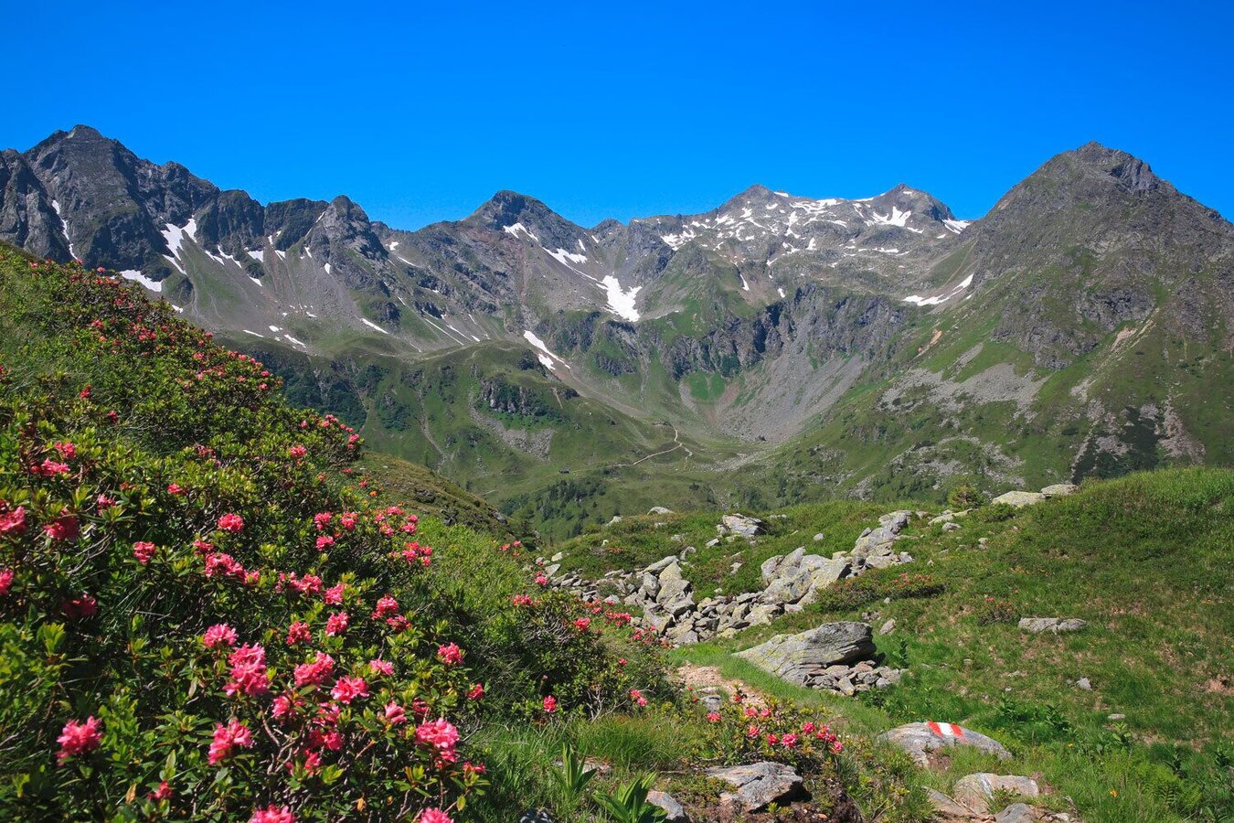
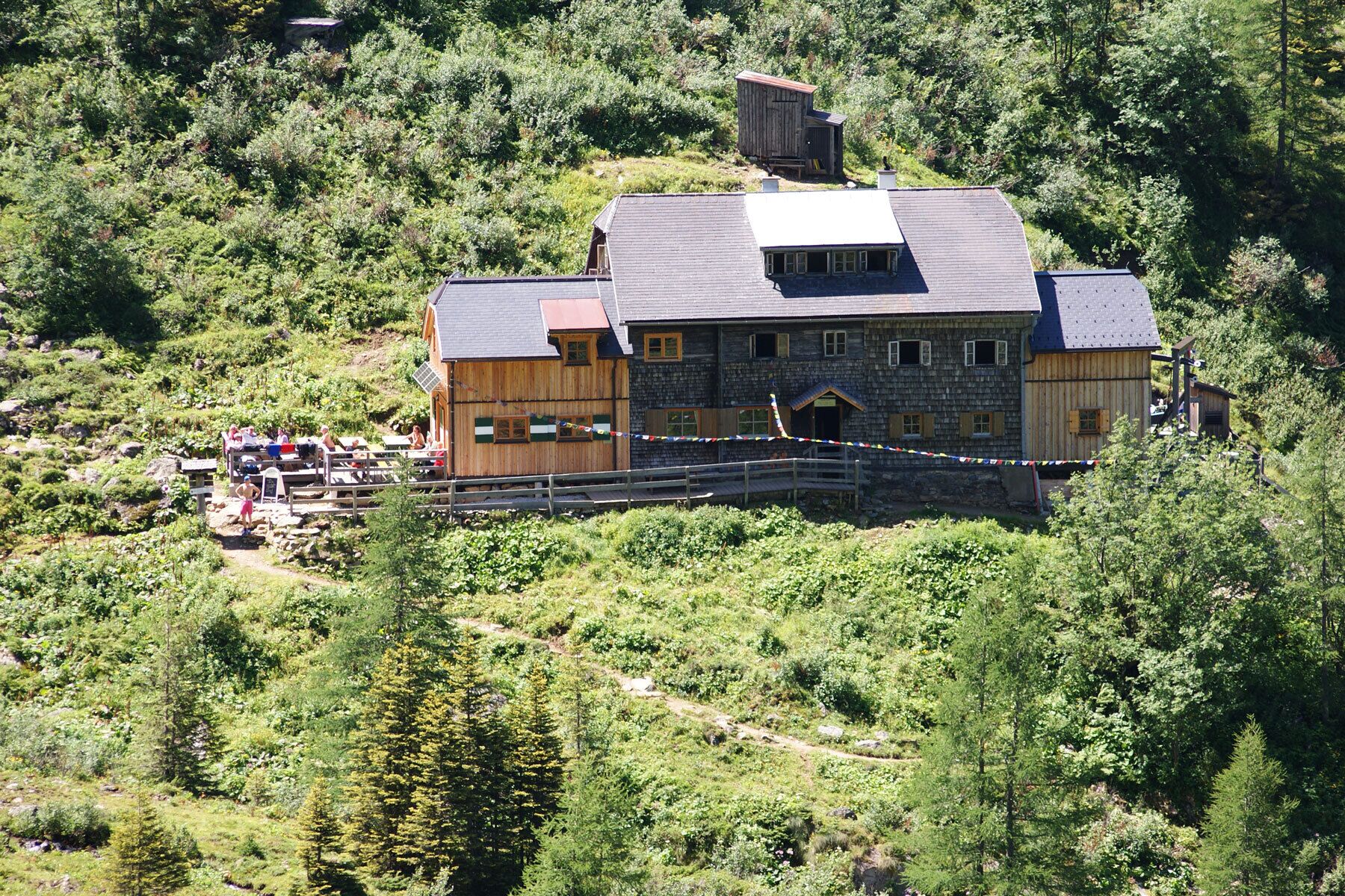
The tour takes you from Keinprechthütte in the Neualm cirque of Obertal valley to Gollinghütte in the Steinriesental valley, which is a tributary valley to the Untertal valley. Along the route you cross over the border of the federal states Styria and Salzburg twice. The alpine trail takes you over alpine meadows and rocky sections to Gollinghütte, whereby you hike over Trockenbrotscharte and Gollingscharte ridges. Inbetween, Landawirseen Lakes and Landawirseehütte chalet & refuge are a good option for a refreshment stop. Before reaching Gollinghütte at the end of the tour, you also walk through the natural amphi-theater of Gollingwinkel, located below the North face of Hochgolling peak.
The tour
Map, elevation profile & further information
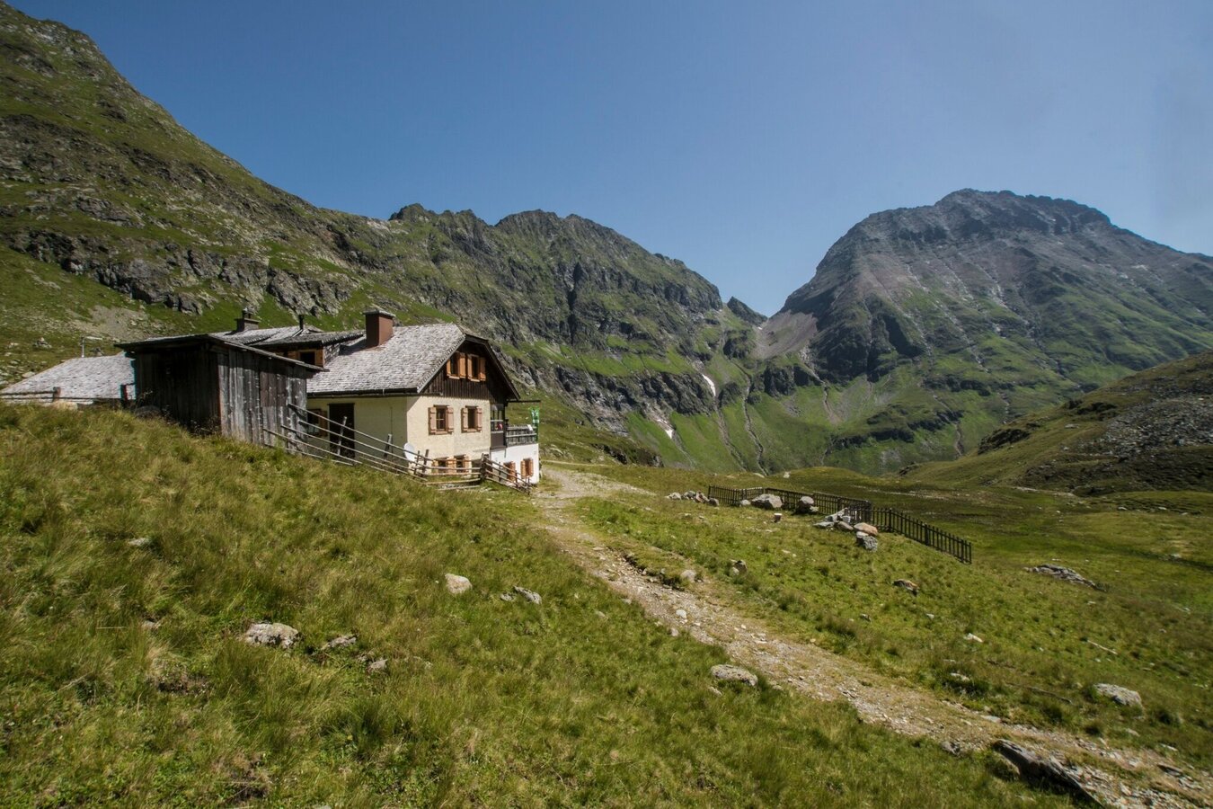
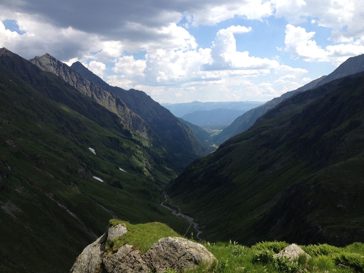
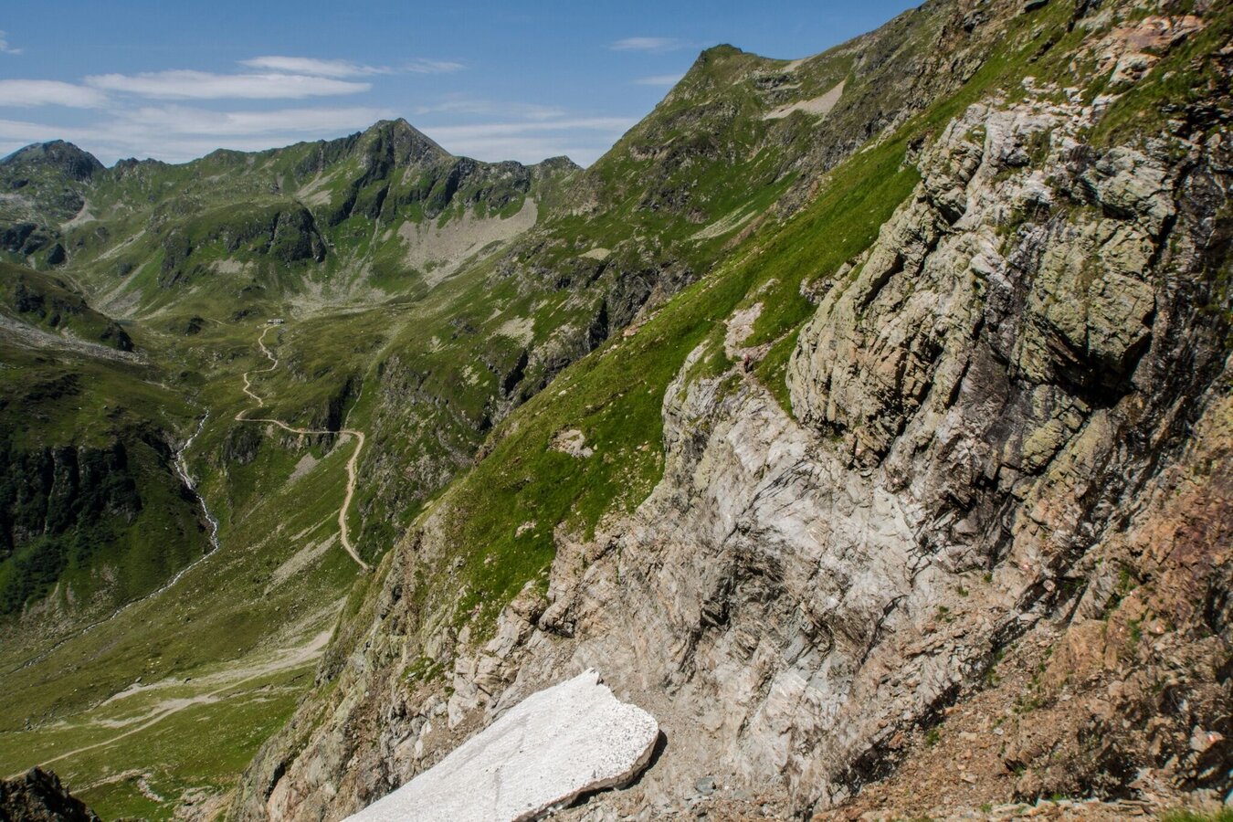
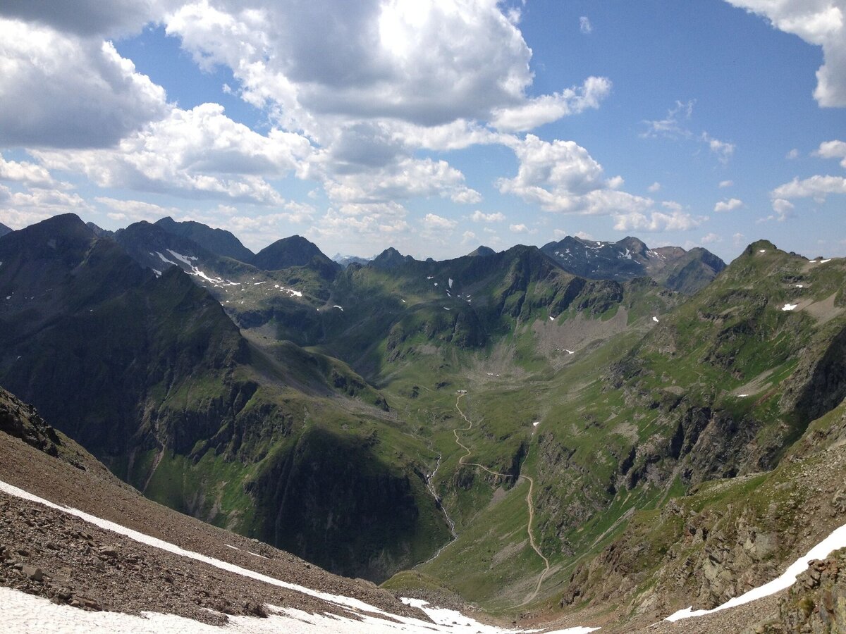
The 3rd stage of the Schladminger Tauern High Trail starts at Keinprechthütte, from where you take trail n° 702 through an extensive cirque until you reach a trail junction. Here you continue toward Trockenbrotscharte and Landawirseehütte. Along the West slope of the cirque and through dwarf pines on the foot of Pietrach mountain and through Gamsfeld you ascend to Trockenbrotscharte ridge (2,237 m). From there you enjoy the view into the cirque where Landawirseehütte is situated and encircled by steep slopes and several summits. In summer, when all the snow from the previous winter is gone, you can turn off left before you even reach the hut and hike to Gollingscharte ridge without much of an ascent or descent. If this trail is closed, you have to descend to Landawirseehütte, hike into the valley head of Göriach valley and ascent up to Gollingscharte ridge via a quite steep trail. Similar to the ascent, you descend from the ridge into Gollingwinkel, an impressive natural amphi theatre on the foot of the might North face of Hochgollling. From there you reach Gollinghütte within 15 minutes.
Descent into the valley:
From Gollinghütte you can descent to Seeleiten car praking in Untertal in approximately 2 hours. From there, the Planai-Hochwurzen bus takes you back to Rohrmoos and Schladming.
Fahrplan: www.planaibus.at
1. stage: Hochwurzen High Trail to Giglachseen Lakes
2. stage: Via Rotmandlspitze to Keinprechthütte
Changes in weather patterns, quick falls in temperature, thunderstorms, wind, fog and snow are some of the dangers that can be encountered on a hiking tour. Hosts of alpine huts and mountain refuges have a lot of experience in the mountains and can give good advice about weather and the trails. Poor equipment, overestimation of one's own capabilities, carelessness, poor personal constitution and/or wrong judgement can lead to critical situations. In case of thunderstorms: avoid summits, ridges and steel ropes.
GPS data and orienteering
Available GPS data - just like hiking maps - is only a guidance for orientation and can never depict a trail exactly with all its details. Especially at dangerous spots it is essential to judge on site how to proceed.
In an emergency please call:
- 140 - for Alpine emergencies (all over Austria)
- 112 - European GSM emergency number
A well-packed backpack is helpful and especially when touring Alpine terrain a tuque, gloves, a windproof jacket and pants are standard equipment. Good, waterproof shoes, sun glasses, sun cream and sufficient beverages are essential too. Torch light, a map of the area, knie and a small first-aid kit should also be in the backpack.
Very ambitious, fit and surefooted hikers can make an ascent to Hochgolling from Gollingscharte ridge via trail no° 778. For this "detour" you need an additional 3 hours.
Info about buses: www.planai.at
360° drone images
Get yourself an overview with our 360° drone images:
- Via Rotmandlspitze: https://vonoben.schladming-dachstein.at/sommer/index.php?S=310
- View into Neualmkar cirque: https://vonoben.schladming-dachstein.at/sommer/index.php?S=312
- At Trockenbrotscharte ridge: https://vonoben.schladming-dachstein.at/sommer/index.php?S=313
- Landawirseen Lakes: https://vonoben.schladming-dachstein.at/sommer/index.php?S=314
- Hiking map Schladming, 1:25.000, available at the tourist office Schladming.
- Hiking map Schladming-Dachstein, 1:50.000, available at the tourist office Schladming.


