
Gröbminger Land
Gumpeneck über Öblarn
Hiking trail
Data:
Tour description
From Öblarn, a challenging but rewarding hike leads to a beautiful mountain with stunning views.
The tour
moderate
Starting and end point
“Staber Parking Lot” on Schattenbergstraße
Tour characteristics
Via ferrata length: 14.2 km
Fitness (4/6)
Skills (3/6)
Information
Distance: 14.2 km
Duration:
6:00 h
Ascent: 1285 m
Descent: 1285 m
highest point: 2226 m
Best season
Jan
Feb
Mar
Apr
May
Jun
Jul
Aug
Sep
Oct
Nov
Dec
Map, elevation profile & further information
The ÖAV – Öblarn Section (trail number: 910) has developed this route to the Zinken and the Gumpeneck.
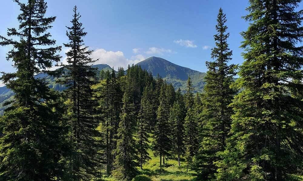
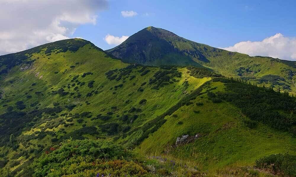
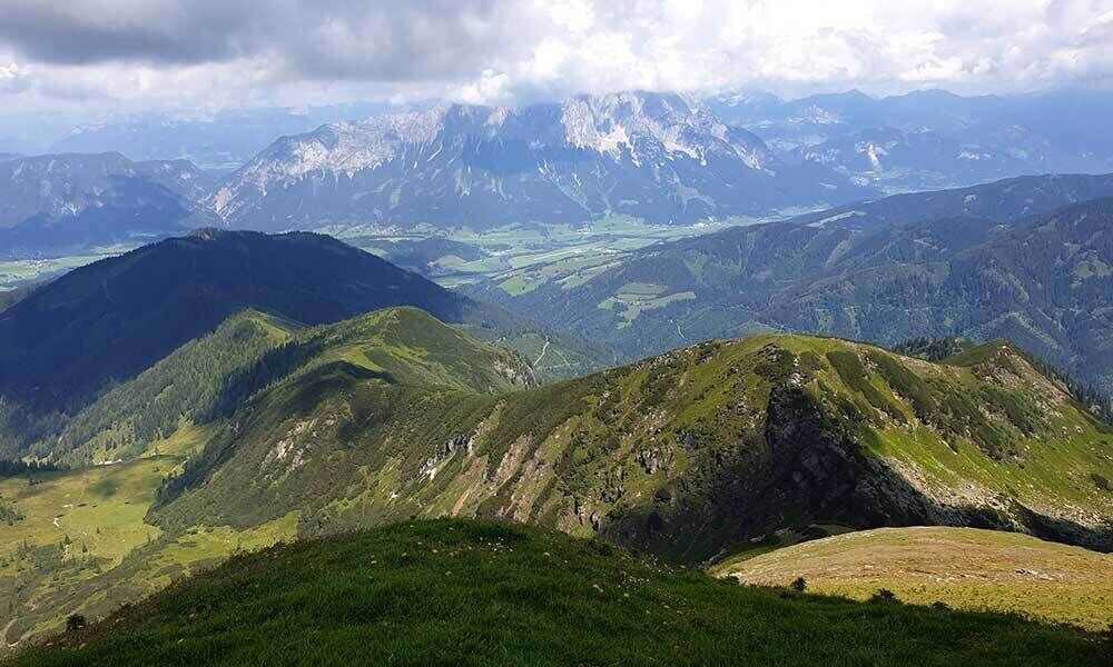
Starting from the parking lot at the end of the paved Schattenbergstraße II, you hike along forest paths up to the Schupfenalm (1,334 m). The route continues over the Schönwetterberg (1,672 m) and the Schupfenriedel, past the Schrettenkarspitze, along a ridge with great views to the Zinken (2,042 m). This is followed by the only, somewhat more difficult section of the tour: a gentle boulder climb downhill into a saddle (approx. 50 meters in elevation). From the saddle, the final ascent leads to the panoramic summit of the Gumpeneck.
Return via the same route or, optionally, descend via the Styrian Regional Circular Hiking Trail toward Großsölk/Schönwetterhütte. Follow Hiking Trail 911 to the Schönwetterberg, where the ascent passed, and take the familiar Trail 910 back to the starting point of the tour.
From the A10: At Altenmarkt (Exit 63), turn toward Graz. Follow the B99 to Radstadt. From there, take the B320 toward Graz. At Pruggern, follow the sign for Öblarn.
From the A9: At Selzthal (Exit 69), turn toward Liezen/Radstadt. From Liezen, take the B320 to Espang. There, turn toward Öblarn.
For the hike: In the center of Öblarn, turn toward the train station. Pass the train station and the funeral home on the left and continue toward Schattenberg. After about 3.5 km, you will pass the Kloiber farm (on the left) and the Staber farm (on the right), where there is a marked parking area on the right side at the end of the paved road.
“Staber Parking Lot” on Schattenbergstraße – Follow the ÖAV signs
Weather changes, rapid drop in temperature, thunderstorms, wind, fog and snow fields are objective dangers and require the right behavior on the way. Hut keepers are experienced mountain connoisseurs, they can give good tips on the weather and the course of the trail. Lack of equipment, overestimation of one's own abilities, carelessness, poor physical condition and a wrong assessment can lead to critical situations. During thunderstorms: avoid peaks, ridges and rope belays at all costs.
GPS data and orientation aids: Available GPS data - as well as hiking maps - are only an orientation aid, since they can never represent an exact image or the richness of detail of a path in reality. Especially in the case of danger spots, it must therefore always be decided in the end on the basis of the conditions on site whether and how the further course of the path looks like.
In case of emergency, please dial the following emergency numbers:
No. 140 - for alpine emergencies - Austria-wide
No. 112 - Euro emergency call GSM emergency call service
Take rainproof and warm clothes and enough water, possibly also a snack, wear shoes with non-slip profile soles. A first aid kit should also be in your backpack.
SummitLynx- Your digital summit and hut book - available worldwide and always with you!For more information, please contact the Schladming Dachstein Tourist Office:
Phone: +43 3687 23310
mailto:info@schladming-dachstein.at
The brochure “Schladming-Dachstein Hiking” is available in all information offices in the region.
Phone: +43 3687 23310
mailto:info@schladming-dachstein.at
The brochure “Schladming-Dachstein Hiking” is available in all information offices in the region.


